How to find out the time of arrival of the bus. Tracking the movement of city transport using the Yandex.Transport application
Do you think it will be faster to get there by bus or by car? I have it parked in the yard, but now it's on the roads ... - an elderly lady turned to us, who were waiting for the bus.
Better by bus!
How soon will it be? It is so good on Suvorovskoye - the information boards are standing and you can immediately see how long to wait, but there are no such boards here.
Now let's see, - my husband took out a smartphone, launched the Yandex.Transport application and reassured me. - In 7 minutes, the bus is already on its way to us.
O! I also have a smartphone, can I watch too? - the lady was interested.
Oh sure.
The desire to know when the right transport will be suitable is quite understandable even on warm days - it is easier to make a decision. After all, what is so good about the center of St. Petersburg is that it is faster to get to many places on foot than to wait first and then go by bus / trolleybus / tram.
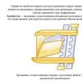
In order to solve the problem of informing Petersburgers GKU "Organizer of transportation" launched a project to equip bus stops with information boards.
And interactive information stands were installed at major stops.

“On the touch screen, you can get information about the arrival time of transport at the nearest stopping points and routes, use an interactive metro map with the ability to calculate the travel time from one metro station to another. In addition, on the screen you can get general information about public transport, fare payments, types of tickets, emergency phone numbers, get acquainted with tourist information (provided by the city tourist information office), etc. "
By the way, they help not only find the bus, but also charge the smartphone.
A special section on the city transport portal helps to see where the necessary transport is at the moment and how you can get in the city from point "A" to point "B" without using the metro. The section is still working in test mode and it is most convenient to search by route number.

Let's say we need a 10 trolleybus. Select, click - search. We get a link on which you can see the location on the map (marked in green), and a list of all stops.


You can also call the information service at 576-55-55. But, honestly, I have not tried this option.
The easiest way so far, as I mentioned above, is the Yandex.Transport application. You need to choose your location, type of transport and flight number. Of course, there is some error in displaying the movement of the same bus. He has already turned on the map, but in reality he is still standing at the crossroads. However, 30-50 seconds is not much of a fundamental difference for a waiting passenger.
The application, which will allow Muscovites to receive information about the time of arrival of a bus, trolleybus or tram at a particular stop, will be implemented in the next two months.
Deputy Mayor of Moscow for Transport and Development of Road and Transport Infrastructure of the City of Moscow Maxim Liksutov said that specialists are currently developing a special application for mobile phones, Interfax reports.
The mobile application will allow you to find out the arrival time of the desired bus, trolleybus or tram. The service, among other things, will have a function for calculating the travel time from the user's location to a transport stop. With its help, the program will be able to notify the passenger when he needs to leave the house in order to catch his bus. The application is currently undergoing final testing.
Maxim Liksutov added that the department has already formed a new transport network. It was created in such a way that the nearest public transport stop from anywhere in the city was no longer than seven to eight minutes on foot. New routes will be presented in early 2014.
Meanwhile, there are now a number of useful sites and applications that help the residents of the capital move around the city with ease.
On the Rusavtobus website, you can enter the addresses from where and where you are going, the time, what time you leave, and the necessary types of transport. The entire path will be laid out on the map, and below it will be written what kind of transport you need to use, how many meters you need to walk on foot, and even what the cost of a taxi will be if you still prefer to go by car.
The official interactive map of the Moscow Metro will show you how to get from one station to another and how long it will take.
On the official website of "Russian Railways" you can find out which train, how long and at what price you can get from point A to point B on the specified date.
The Wiki Routes website will draw a given route on the map, tell you which bus you need to get on and at which stop to get off, calculate how many meters you need to walk.
The Mostransavto website will tell you in detail about the public transport routes of the Moscow region - just enter the name of the stop or the route number.
"Yandex. Schedules" will offer the routes of planes, trains, trains and buses if you want to get out of the city.
Of the free applications, Transport of Moscow is very functional: you can plot a car route, find out where parking lots, traffic cameras, refueling with the "right" and "wrong" fuel are located, check whether a taxi is operating legally, see your fines, send a message the owner of the car that blocked the exit. The app also contains information on traffic rules, fines and violations, public transport fares and even the latest traffic news. Among other things, the application allows you to check if your car has been evacuated. Available for iOS, Android and Windows Phone.
The useful application "iGodebus" will advise you on what transport to choose for your route, and even be able to determine from a photo at which stop you are. In addition, the application works offline, so it won't stop working if there is an interruption in the connection. The developers warn that running the application can quickly drain the device. IOS only.
Using the Moscow Parking application, Moscow motorists can find out where to park their car and how to get to the desired parking lot. You can also pay for parking directly from the application. Available for iOS, Android and Windows Phone.
Yandex.Taxi is one of the most convenient for ordering a taxi: you can select the desired taxi fleet and price category, warn the driver that you need a child seat, see the called car on the map, and much more. You will be notified by SMS about when the driver will be there and how much the trip cost. Available for iOS, Windows Phone and Android.
MosParking is a good "parking" application that will show on a map or with a simple list all paid and free parking lots near your location and provide all the information about each of them.
The Metropolitan app will determine which metro station is closest to your location, just in case, it will show how many meters the other stations are, draw a route on a diagram and calculate how many minutes the journey will take. IOS only.
Details Category: Android Applications Published on 10/14/2014 19:03 Views: 1359Dear friends, users of the Android system!
Today I will introduce you to an application that will save you from the uncertainty of waiting for public transport at a bus stop. You probably often had to stand at a bus stop, waiting for the right transport and cursing the discrepancy between the posted schedule and reality. With traffic jams now common in big cities, it is difficult to count on the accuracy of arrival on schedule.
There is an exit. If you are the owner of a smartphone with Internet access, then using a good free of Yandex.Transport program, you can at any time see on the map at the place of your current location (however, if necessary, also in any other one), the real traffic situation on the approaches to your stop.
![]()
Application when opened determines your location and when you click on the arrow in the lower left corner, it centers the map on it.
On the map in real time appear moving marks buses, trolleybuses, trams, indicating the route number and direction of travel. Using these marks, you can roughly determine whether the necessary transport is on the way, how long you still have to wait for it, and decide whether it is worth finding alternative options. There is a filter with which you can leave only the route you need on the map.
![]()
At clicking the stop icon you get a list of all the routes that stop on it. When you press per transport label you get its end stops.
In my experience, the accuracy of displaying the real position is not perfect, but still very decent. The time error is no more than 1-2 minutes. It is only necessary to take into account that, of course, only vehicles equipped with a navigation system are displayed, and there are more and more of them.
You can also overlay on the map traffic information from the Yandex.Traffic service by clicking on the traffic light in the upper left.
In short, a very convenient application, it helped out more than once. Naturally, it requires an Internet connection to work.
22.03.2017
Thanks to the widespread introduction of GPS and GLONASS technologies in the civil sector, anyone can track not only their location, but also the movement of public transport (the only exception is the subway).
Special applications for smartphones and computers allow you to track the movement of buses and minibuses in Moscow online. True, sometimes the readings can be a little inaccurate.
List of applications
Using one of the services presented, you can track the movement of vehicles in real time:
- Yandex.Transport is an application for smartphones running Android and iOS. Installation on a computer is possible only using a special emulator. You can download it from the Play Market or AppStore.
- TransNavi website - allows you to track the movement of public transport within Moscow and the region online, from any device. The site is still working in test mode, so sometimes it can give some glitches.
- 2GIS is another application for computers and smartphones that allows you to find out the time when the desired bus / trolleybus / minibus will come to the stop.
Method 1: using Yandex.Transport
Step-by-step instructions for using the application:
Method 2: use the official website Navitrans.Info
On this site you can also track the desired vehicle, find a stop and get directions. Works only within Moscow and the Region. Instructions:

Method 3: 2GIS
This application is available for both smartphones and PCs. It is possible to work offline (without a network connection), but to track traffic, then you will need to connect to a GPS or GLONASS network. In fact, it is not the bus that is tracked, but the time when it comes to the specified stop is calculated. This function may work with some interruptions (it works most correctly in Ufa and Nizhny Novgorod).
To use this function, click on the desired stop. A pop-up window will indicate the buses that stop on it. The estimated time of arrival will be written in front of the bus number.

Tracking the movement of a bus on the territory of Moscow and the Region is not difficult. You can use this opportunity both from a smartphone and from a stationary PC that is connected to the Internet.
Every week Look At Me talks about one notable app that is changing the way we think about mobile interfaces and figuring out what's behind the App Store icon - ideas, technologies, developers. In the new issue - a conversation with the creators of the ETransport application, which allows you to track the movement of urban public transport.
The ET transport application finds the stops closest to the user and displays the direction of travel on them. It is enough to select the desired stop, and the application will calculate how many minutes this or that public transport will arrive.
ETransport provides users with the ability to create their own list of favorite stops and routes, so they don't have to re-search for the ones they use most.
A tab with a list of favorite stops and routes can be made start- this will simplify the process of using the application.
The ET Transport application also stores several of the last stops and routes viewed by the user.
The movement of public transport in the application can be tracked both on an interactive map, and according to the list with information about the time of arrival and distance.


The free ETransport application collects information about the location of urban transport equipped with GLONASS sensors, and calculates the arrival time of buses, trolleybuses and trams at a specific stop. The application automatically detects the user's location and prompts him to select one of the nearest stops on an interactive map. Further on the screen a list of routes and the time after which this or that public transport will arrive at the stop are displayed. Thanks to this, you can save time and correctly plan your route. Also in the ETransport application there is a function of saving favorite stops and the ability to view the history of your movements.
“When we were students and just starting our small business- a mobile app development firm - we lacked an interesting project for a portfolio. I wanted to come to a potential client and say: “Do you know ETransport? We did it! " That is, initially it was a kind of side-project, but in the end it was he who attracted new clients.
The principle of operation of the application is quite simple - ETransport determines the user's location and offers to select the nearest transport stops on an interactive map, and then shows the approaching transport and the time after which it will arrive at the stop. The biggest problem associated with the launch of ETransport is that it is necessary to negotiate with the city authorities about the right to access the data of a specific location of all public transport units. In my opinion, this is strange - after all, the convenient service that we create for the townspeople is in the hands of any government. Moreover, this is simply wrong - such data cannot be hidden, they must be in the public domain. In this regard, Peter is at the forefront: the authorities there not only opened this data to everyone, but also encourage the developers of such projects (but ETransport is currently considered the best in terms of functionality). In about 40 other cities, no one hides transport location data, but in Moscow they are practically classified.
In the coming month, we will launch ETransport in 11 more cities in Russia, but so far I cannot disclose information about which cities are included in this list. I think their residents will definitely not miss this event. In Moscow, for example, in the first four days we attracted more than 40 thousand users. Unfortunately, not everyone noticed that Moscow (like, by the way, St. Petersburg) is still in beta testing, and there are not many stops and routes in the application yet, and the information on the location of the transport itself may differ from the real situation.
Promotional video ETransport
In the future, we will definitely add to the application the function of building a route "from point to point", as well as the ability to calculate the travel time and even warn your friends about how many minutes you will arrive. We will also remind users in advance that it is time to leave the house so as not to miss our tram, otherwise the next one will not arrive soon. We will pay more attention to ensuring that users can communicate with each other, choose the "King of the Roads" or "Mayor of the Stop." We want people to share valuable information with each other (for example, that there is control on the line) and discuss different things like rude drivers and singing conductors.
Our team consists of five people. I studied at the Gorky Ural State University, where I met Maxim Rovkin, our Android developer. He brought an incredible server-man Pasha Dick to our team - on the eve of the most difficult test in the entire training period, he worked all night to ensure that our application in Moscow was launched on time and without problems. It's funny, but we first met our iOS developer Egor Eremeev live after the release of the first version of ETransport. Egor and Max met when they took the Unified State Exam in different cities (Egor - in Naberezhnye Chelny, and Maxim - in Yekaterinburg), but with the same diligence they solved tests for the Far East. Designer Pasha Osipkin found us himself - in January 2013 we received a letter from him in the mail, saying that your application is excellent, but the design is shit. This is how Pasha became a part of our team, which we are still incredibly happy about ”.
 Informatics presentation "Archivators
 Computer Information Modeling Computer Modeling Presentation
 Presentation programming environment pascal