Basics of satellite navigation. The main characteristics of navigation satellite systems
Main elements
The main elements of the navigation satellite system:
- Orbital grouping consisting of several (from 2 to 30) satellites emitting special radio signals;
- Ground management and control system (ground segment), including blocks of measuring the current position of satellites and transmitting information to them to adjust information about orbits;
- Reception client equipment ("satellite navigators") used to determine the coordinates;
- Optionally: ground system of radio beacons, which makes it possible to significantly improve the accuracy of determining the coordinates.
- Optionally: an information radio system for transmitting users amendments to significantly improve the accuracy of determining the coordinates.
Principle of operation
The principle of operation of satellite navigation systems is based on measuring the distance from the antenna at the facility (which must be obtained) to satellites, the position of which is known with great accuracy. Table of positions of all satellites is called almanacwhich should have any satellite receiver before the measurement starts. Usually the receiver saves almanac in memory since the last shutdown and if it is not outdated - instantly uses it. Each satellite transmits all almanac in its signal. Thus, knowing the distances to several system satellites, using conventional geometric constructions, based on almanac, you can calculate the position of the object in space.
The method of measuring the distance from the satellite to the receiver antenna is based on the definition of the propagation rate of radio waves. For the possibility of measuring the time of the radio signal distributed each satellite navigation system Rades the exact time signals using atomic clocks accurately synchronized with system time. When using a satellite receiver, its clock is synchronized with the system time, and with further receiving signals, the delay is calculated between the radiation time contained in the signal itself, and the signal reception time. Having this information, the navigation receiver calculates the antenna coordinates. All other motion parameters (speed, course traveled) are calculated based on the measurement of time that the object spent on moving between two or more points with certain coordinates.
In reality, the operation of the system is much more complicated. Below are some problems that require special technical techniques to solve them:
- Lack of atomic watches in most navigation receivers. This deficiency is usually eliminated by the requirement of obtaining information at least with three (2-dimensional navigation at a well-known height) or four (3-dimensional navigation) of satellites; (If there is a signal at least one satellite, you can determine the current time with good accuracy).
- Heterogeneity of the gravitational field of the Earth, affecting the orbits of satellites;
- The inhomogeneity of the atmosphere, due to which the speed and direction of the propagation of radio waves may vary in some limits;
- Reflection signals from land objects, which is especially noticeable in the city;
- The impossibility of placing high-power transmitters on satellites, which is why the reception of their signals is possible only in direct visibility in the outdoor.
Apply Navigation systems
In addition to navigation, the coordinates obtained by satellite systems are used in the following industries:
- Geodesy: With the help of navigation systems, the exact coordinates of the points are determined.
- Cartography: Navigation systems are used in civil and military cartography
- NAVIGATION: Using navigation systems is carried out both marine and road navigation
- Satellite transport monitoring: With the help of navigation systems, monitoring for the position, vehicle speed, control over their movement
- Cellular communication: first cell phones With GPS appeared in the 90s. In some countries (for example, USA), this is used to promptly determine the location of a person calling 911. In Russia, the implementation of a similar project was launched in 2010 - ERA-GLONASS.
- Tectonics, Tectonics Plates: With the help of navigation systems, movements and oscillations of plates are observed
- Active rest: There are various games where the navigation systems are used, for example, geocaching, etc.
- GeoteGing: information, such as photos "tied" to coordinates thanks to built-in or external GPS receivers
Modern condition
The following satellite navigation systems are currently working or prepared for deployment:
GPS.
Belongs to the US Department of Defense. This fact, according to some states, is its main disadvantage. The devices supporting GPS navigation are the most common in the world. Also known under the earlier name Navstar.
GLONASS
Belongs to the Ministry of Defense of Russia. The system, according to the statements of terrestrial equipment, will have some technical advantages compared to GPS. After 1996, the satellite group was reduced and by 2002 almost completely decline. It was completely restored only at the end of 2011. There is a small prevalence of client equipment. By 2025, deep modernization of the system is supposed.
Baidou
The GNSS subsystem deployed by China is designed for use only in this country. Feature - a small number of satellites located on a geostationary orbit. IN currently Eight navigation satellites are displayed in the orbit. According to the plans, by 2012, it will be able to cover the Asia-Pacific region, and by 2020, when the number of satellites will be increased to 35, the Baidou system will be able to work as global. The implementation of this program began in 2000. The first satellite went into orbit in the 2007th.
Galileo.
The European system located at the stage of creating a satellite grouping. It is planned to fully deploy a satellite group by 2020.
Irnss.
Indian navigation satellite system, in a state of development. It is assumed for use only in this country. The first satellite was launched in 2008.
QZSS.
Initially, the Japanese QZSS was conceived in 2002 as a commercial system with a set of services for mobile communications, broadcasting and widespread use for navigating in Japan and neighboring areas of Southeast Asia. The first launch of the satellite for QZSS was scheduled for 2008. In March 2006, the Japanese government announced that the first satellite would not be intended for commercial use and would be launched entirely on budgetary funds for the development of decisions taken in the interests of ensuring the solution of navigation problems. Only after the successful completion of the test of the first satellite will begin the second stage and the following satellites will fully ensure the amount planned earlier.
The main characteristics of navigation satellite systems
| parameter, method | SRNS GLONASS | GPS Navstar | Ten Galileo. |
|---|---|---|---|
| NA number (reserve) | 24 (3) | 24 (3) | 27 (3) |
| Number of orbital planes | 3 | 6 | 3 |
| NA number in the orbital plane | 8 | 4 | 9 |
| Type of orbit | Circular (E \u003d 0 ± 0.01) | Circular | Circular |
| Height orbit, km | 19100 | 20183 | 23224 |
| Calculation of orbit, degrees | 64.8 ± 0.3. | ~55 (63) | 56 |
| Nominal period of circulation by average sunny time | 11h 15min 44 ± 5c | ~ 11h 58 min | 14 h 4 min. and 42 p. |
| The method of separation of NS signals | Frequency | Code | Code-frequency |
| Carrier frequencies of radio signals, MHz | L1 \u003d 1602.5625 ... 1615.5 L2 \u003d 1246.4375 ... 1256.5 | L1 \u003d 1575.42 L2 \u003d 1227.60 L5 \u003d 1176.45 | E1 \u003d 1575.42 E5 \u003d 1191.795 E5A \u003d 1176.46 E5B \u003d 1207.14 E6 \u003d 12787.75 |
| repeating period of the rangefinder code (or its segment) | 1 ms. | 1 ms (C / A-code) | there is no data |
| type of rangefinder code | M-sequence (ST code 511 zn.) | Gold code (C / A-code 1023 zn.) | M-sequence |
| raverstall clock frequency, MHz | 0.511 | 1.023 (C / A-code) 10.23 (p, y-code) | E1 \u003d 1.023 E5 \u003d 10.23 E6 \u003d 5.115 |
| Digital Information Transmission Speed \u200b\u200b(respectively, Si- and D- code) | 50 zn / s (50Hz) | 50 zn / s (50Hz) | 25, 50, 125, 500, 100 Hz |
| Duration of the superframe, min | 2,5 | 12,5 | 5 |
| The number of frames in the supercadre | 5 | 25 | there is no data |
| The number of rows in the frame | 15 | 5 | there is no data |
| Time reference system | UTS (SU) | UTS (USNO) | UTS (GST) |
| Coordinate reference system | PZ-90 / PZ90.2 | WGS-84. | Etrf-00. |
| Type Efemirid. | Geocentric coordinates and their derivatives | Modified Kepler elements | |
| Sector of radiation from direction to the center of the Earth | ± 19 in 0 | L1 \u003d ± 21 in 0 L2 \u003d ± 23.5 in 0 | there is no data |
| Sector Earth | ± 14.1 in 0 | ± 13.5 to 0 | there is no data |
Technical details of systems
Consider some of the features of the main existing satellite navigation systems (GPS and GLONASS):
Differential dimension
Separate models of satellite receivers make it possible to produce. "Differential dimension" distances between two points with great accuracy (centimeters). For this, the position of the navigator is measured at two points with a short period of time. At the same time, although each such measurement has an accuracy of about 10-15 meters without a ground adjustment system and 10-50 cm with such a system, the measured distance has a lot less error, since the factors that interfere with the measurement (error of satellite orbits, inhomogeneity of the atmosphere in this place Earth, etc.) in this case mutually deducted. In addition, there are several systems that send clarifying information ("differential amendment to coordinates"), which allows to improve the accuracy of measuring the coordinates of the receiver to ten centimeters. The differential amendment is sent either from geostationary satellites, or from ground base stations, may be paid (the signal decoding is possible only by one defined receiver after payment "Subscriptions to the service") or free.
see also
| Satellite navigation system on wikisklad |
- Pseudo-seater
Notes
Links
International Satellite Navigation Forum Event dedicated to satellite navigation issues
Mobile GIS for Forestry enterprises GPS Navigation, Forest Satellite Data Control Satellite Snapshots, Leskhoz Map, Taxation Description in Mobile Phone.
| Navigation systems | |||||||||
|---|---|---|---|---|---|---|---|---|---|
| Satellite |
|
||||||||
| Ground | Omega Alpha Loran-C Seagull Decca Consol | ||||||||
| Satellite navigation | |
|---|---|
| Systems | GPS Glonass Galileo Beidow |
| GPS devices | Receiver tracker Logger |
| Chipsets | SirfStar III Sirfatlasiv Sirfatlasv |
| Protocols | NMEA. |
| Technologies | A-GPS. S-GPS. |
| Projects | Geokshing Search for intersections Altergeo. GPS-Trace Orange |
| Cartography services | |
Satellite navigation systems GPS and GLONASS were created on the basis of certain requirements corresponding to their direct intended purpose. Implied their globality; independence from meteorological conditions, terrain relief, the degree of mobility of the object; continuity of work and round-the-clock availability; noise immunity; Competrator's equipment compactness, etc.
Civilian applications SNS, which developed after the development of the concept of GLONASS and GPS systems, especially such as civil air traffic management, navigation of ships, rescue work, has improved requirements for the availability, integrity and continuity of service. Let us give the definition of these important terms:
Availability (readiness) is the degree of probability of SNS operability before its use and in the process of use.
Integrity is the degree of likelihood of system failure during a specified time or faster.
Service continuity is the degree of probability of maintaining the continuous operation of the system at a given period of time.
Under a given time interval, as a rule, it is understood by a period of time, most important with practical point Vision, for example, the airliner at the landing aircraft. Currently, among civilian applications, the most critical SNS is controlled by air traffic, including navigation provision of aircraft. Requirements for accessibility depend on the flight stages and the intensity of air traffic. Availability at route flight should not be worse than 0.9999 ... 0,999999; When flying in the zo-non-aerodrome and a non-iced approach to landing is not worse than 0.999999. Integrity requirements are achieved in accordance with ICAO requirements, values \u200b\u200b0.999999995 with permissible prevention time no more than 1 seconds. These data show how large the requirements for the reliability of the SNA consumers are reserved.
In the SNA GLONASS and GPS, high operational characteristics at the structural level are achieved by jointly functioning the three main segments:
Space segment;
Control segment;
Consumer segment.
In addition to the main segments there is such a functional addition as the differential subsystem (DGPS) and a number of auxiliary elements: special Channels land and space communications, means of outputting satellites in orbit, etc.
The basis of the SNA concept of GLONASS and GPS was the independence and unsquisition of navigation definitions. Independence implies the definition of the desired navigation given data, but at the modern level of electronics development, such complications no longer matters. The unsquarification of the system means that all calculations in the equipment of the consumer are calculated only on the basis of passively received signals from the NCA with in advance those known orbital coordinates. In turn, the lack of need to transfer a request from the consumer to the NCA allows you to make the consumer equipment very compact and economical.
Space segment.
The accuracy of the location and stability of the functioning of the SNA is largely depends on the mutual orbital location of satellites and the parameters of their signals. As a rule, it is required that in the visibility zone of the consumer were at least 3 - 5 NCAs. In practice, the orbital structure is built in such a way that more than 6 NCAs are constantly visible for most consumers and the consumer has the ability to choose the optimal constellation on a specific algorithm laid in the receiver's calculator. In addition to the current NCA, the completed SNA has several backup satellites in its composition, which can be promptly introduced to replace failed or to increase the degree of coverage of a certain region. Acting NCAs can be regrouped (in limited limits) by a command from a ground control station. Currently active medium orbits with a height of about 20,000 km allow you to take signals of each NCA at almost half of the surface of the Earth, which ensures the continuity of the radio navigation field and sufficient redundancy when choosing the optimal NCA constellation. GPS and GLONASS systems are often called network SNAs, since mutual synchronization of the NCA in orbital coordinates and parameters of the emitted signals are of fundamental importance for their operation. Combining the NCA group to the network.
The main value of the NCA is the formation and radiation of the signals necessary to solve the consumer of the problem of positioning and monitoring the health of the NCA itself. The standard NCA includes: radio transmitting equipment for transmitting a navigation signal and telemetry information; radio equipment for receiving commands of the ground control complex; antennas; onboard EMV; onboard standard and frequency; solar panels; rechargeable batteries; Orientation systems in orbit, etc. Modern NCAs can carry concomitant equipment, such as detectors to detect ground nuclear explosions and elements of combat control systems.
Radiated NCA signals contain range finding and service components. The range finding component is used by consumers directly to determine the navigation parameters - the range to the NCA, the consumer speed vector, its spatial orientation, etc. The service component contains information about the coordinates of satellites, time scale, vestment venographs, serviceability, etc. Basically, official information is preparing a command and measuring complex and is laid in the side memory of the NCA during a communication session. And only insignificant part of it is formed onboard equipment. The procedure for transferring official information from the command complex to the memory of on-board computer is often called data loading.
The rangefinder component contains components of standard and high accuracy. Standard measurement accuracy is available to all consumers, and high - only authorized, i.e. having permission of military controls. Access separation is achieved by encoding high accuracy signals.
Under conditions of military operations, attempts at the formulation of intentional interference in order to suppress SNS signal (jaming) and attempts to impose (spoofing), i.e. Signal substitutions and input to the adapter's reception equipment are obviously false information with third-party transmitters. Since the literature quite rarely meets a clear interpretation of the term "anti-spoofing" in relation to the SNA, it should be especially emphasized that it is about protecting against imposition.
Control segment.
The management segment consists of a main station combined with a computing center; groups of control and measuring stations (kisa) associated with the main station and among themselves communication channels; Land reference time and frequency. The control and measuring stations are stable to be placed as uniformly as possible on the surface of the Earth, consistent with geopolitical factors and economic feasibility. The coordinates of the KIS (the antenna phase center) are defined in three dimensions with the most accessible accuracy. When the NCA span in the visibility zone, it monitors the satellite, accepts navigation signals, performs primary processing of information and exchanges data from the main standard. On the main station there is a collection of information from all kisa, its mathematical processing and calculation of various coordinate and corrective data to be loaded into the onboard computer NCA.
Data to be downloaded is divided into operational, updated with each communication session, and long-term. In the event of an emergency situation, it is possible to carry out unscheduled communication sessions and load data subject to NCA in the visibility zone of one of the kit.
The ground standard and frequency and frequency has higher accuracy than onboard standards and is designed to synchronize all processes occurring in the SNA and the correction of onboard standards.
The combination of independence and unsquisition gives the SNS unlimited throughput - An arbitrary number of consumers can use SNA signals at any time.
Consumer segment.
Consumer segments can be consecrated into three parts: military organizations; civil organizations; Private faces. Regardless of the purpose of consumer equipment, it has a radio frequency path in which the NCA radio signals and their primary processing are taking place, and the calculator intended for secondary signal processing, the allocation of navigation information, the implementation of the algorithm for calculating the optimal constellation and calculating the spatial coordinates and the consumer velocity vector. Usually, the current coordinates of the NCA and the range are determined, then the geographical coordinates of the consumer are calculated. The consumer speed vector is calculated by measuring the Doppler NCA frequency shifts with known satellite velocity vector. For non-critical transport applications, the speed vector can be calculated on the difference in coordinates in two fixed time. Further, depending on the assignment of the receiver, the information can enter the display device, to the transmission channel, or on the control unit of external actuating mechanisms.
Determining the current NCA coordinates.
Despite some similarity with radio label navigation systems (unsumeration, rangefinder method), SNS also have significant differences. The coordinates of the radio beacons are unchanged and are known in advance, while the coordinates of the NCA need to constantly find. The determination of the current NCA coordinates moving with large non-permanent speeds with speeds is a complex technical and computational task.
With an existing approach to the construction of the SNA, the maximum possible amount of calculations is trying to transfer to the ground control complex. Measuring stations are located in limited territories and do not provide continuous observation of the NCA. According to the results of available observations in the computational center of the main command station, the parameters of the NCA orbits are calculated. They are subject to mathematical processing on elimination algorithms. Then, on the basis of the processed data, the forecast of the parameters of the orbit in fixed (survey) moments of time up to the development of the following forecast.
The predicted parameters of the orbit and their derivatives are called ephemeris. During ephemeris communication session, it is transmitted to the NCA, and then in the form of a navigation message containing ephemerides and the corresponding time-tags - consumers. Knowing the alleged orbit parameters and the exact coordinates of the NCA at the reference points in time, the consumer can calculate the NCA coordinates during an arbitrary moment of time. In addition to the ephemeride, the navigation message is laid by almanac - a set of information about the current state of the SNA as a whole, including cluttered ephemerides used to search for visible NCA and choosing the optimal constellation.
Generally accepted units of time.
Consideration of the principles of construction and functioning of satellite navigation systems is impossible without prior to familiarize with the basic concepts relating to the units of time measures. These units are used to determine the spatial position of the NCA, the binding of the NCA signals to a single scale of time, etc.
It is customary to distinguish between two groups of time counting units:
Astronomical;
Naestronomic.
The main astronomical unit of reference is the day, broken at 86400s and equal time interval for which the land makes one full turn around its axis relative to a certain fixed point of reference on the celestial sphere, for a fixed observer located on the ground surface. A characteristic feature of astronomical day is that depending on the selected point of reference (the center of the visible DISC of the Sun, the Point of Spring Equinox, etc.), the day have different duration and differ by name.
Star day. The time interval measured between two consecutive upper climax of the point of spring equinox is called starry days, or, otherwise, the stellar period of circulation of the Earth. The time measured on a certain meridian is called local time of this meridian. Therefore, in the case of starday, they talk about local time of the Meridian.
Local time is measured by the time angle of the position of the spring equinox relative to the celestial meridian. Under the celestial meridian, the projection of the earth's meridian on the conditional surface of the celestial sphere is understood, so the hour angle is similar to the geographical longitude, it is counted from the hourly meridian of the observer clockwise and is measured in hours, minutes, seconds.
It is known that the axis of the rotation of the Earth performs slow periodic movements, consisting of movements along the cone - precessions, and small oscillations - nutations. Precession and nation make an error in the definition of stellar time, since because of them, the point of spring equinox is moved. If only precession takes into account when calculating, then the average time is obtained. When, together with the precession, the latter is taken into account, then true Starry time is obtained. Starry time measured in Greenwich Meridian is called Greenwich Star Time.
Satellite GPS navigation has long been a standard for creating positioning systems and is actively used in various trackers and navigators. The Arduino GPS projects are integrated with various modules that do not require knowledge of theoretical foundations. But the present engineer should be interesting to figure out the principle and scheme gPS operationsTo better understand the possibilities and limitations of this technology.
GPS operation scheme
GPS is a satellite navigation system developed by the US Department of Defense, which defines the exact coordinates and time. It works at any point of the Earth in all weather conditions. GPS consists of three parts - satellites, stations on earth and signal receivers.
The idea of \u200b\u200bcreating a satellite navigation system originated in the 50s of the last century. An American group of scientists, who observes the launch of Soviet satellites, noticed that when the satellite approaches the signal, the signal frequency increases and decreases during its distance. This made it possible to understand that it was possible to measure the position and speed of the satellite, knowing their coordinates on Earth, and vice versa. A huge role in the development of the navigation system was played by the launch of satellites on a low near-earth orbit. And in 1973, the DNSS program was created ("NAVSTAR"), according to this program, satellites were launched on the middle near-earth orbit. The name GPS program received in the same 1973.
The GPS system is currently used not only in the military field, but also for civilian purposes. Spheres gPS applications lot:
- Mobile connection;
- Tectonics of plates - tracking of the oscillations of the plates;
- Determination of seismic activity;
- Satellite transport tracking - you can monitor the position, vehicle speed and control their movement;
- Geodesy - determination of the exact boundaries of land plots;
- Cartography;
- Navigation;
- Games, geothythic and other entertainment areas.
The most important disadvantage of the system can be considered the impossibility of signaling under certain conditions. GPS operating frequencies lie in the decimeter wave range. This leads to the signal level may decrease due to high cloudiness, dense tree foliage. Radio sources, muffler, and in rare cases even magnetic storms can also interfere with normal signal transmission. The accuracy of determining the data will deteriorate in the indoor areas, as the satellites are low raised above the ground.
Navigation without GPS.
 The main GPS competitor is the Russian GLONASS system (global navigation satellite system). The system began its full work since 2010, attempts to actively use it from 1995. There are several differences between the two systems:
- Different encodings - Americans use CDMA, the Russian system uses FDMA;
- Different dimensions - GLONASS devices use a more complex model, so the power consumption and dimensions of the devices increase;
- The arrangement and movement of satellites in orbit - the Russian system provides wider coverage of the territory and more accurate determination of coordinates and time.
- Satellite service life - American satellites are made better, so they serve longer.
In addition to GLONASS and GPS, there are other less popular navigation systems - European Galileo and Chinese Beidou.
GPS description
GPS operation principle
The GPS system works as follows - the signal receiver measures the signal propagation delay from the satellite to the receiver. From the resulting signal, the receiver receives data on the location of the satellite. To determine the distance from the satellite to the receiver, the signal delay is multiplied by the speed of light.
 From the point of view of geometry, the work of the navigation system can be illustrated as follows: several areas, in the middle of which are satellites, intersect and the user is located in them. The radius of each of the spheres is respectively equal to the distance to this visible satellite. Signals from three satellites make it possible to obtain data on latitude and longitude, the fourth satellite gives information about the height of the object above the surface. The obtained values \u200b\u200bcan be reduced to the system of equations from which you can find the user coordinate. Thus, to obtain an exact location, it is necessary to carry out 4 measurements of the range to the satellite (if you exclude implausible results, three sufficient measurements).

The amendments to the obtained equations make a discrepancy between the calculated and actual position of the satellite. The error that occurs as a result of this is called ephemeris and ranges from 1 to 5 meters. Interference, atmospheric pressure, humidity, temperature, influence of the ionosphere and the atmosphere are also contributed. The total set of all errors can bring the error up to 100 meters. Some errors can be eliminated mathematically.
To reduce all errors, use the Differential GPS mode. In it, the receiver receives all the necessary corrections to the coordinates from the radio channel base station. The total measurement accuracy reaches 1-5 meters. With differential mode, there are 2 methods for adjusting the data obtained - this is the correction of the coordinate themselves and the correction of navigation parameters. The first method is inconvenient, as all users must work according to the same satellites. In the second case, the complexity of the device itself is significantly increasing.
There is a new class of systems that increases the measurement accuracy of up to 1 cm. A huge effect on accuracy has an angle between directions for satellites. With a large corner, the location will be determined with greater accuracy.
The measurement accuracy may be artificially reduced by the US Department of Defense. To do this, a special S / A mode is installed on navigation devices - limited access. The mode is designed for military purposes in order not to give the enemy the advantages in determining the exact coordinates. Since May 2000, regime limited access was cancelled.
All sources of errors can be divided into several groups:
- Error in calculating orbits;
- Errors associated with the receiver;
- Errors associated with repeated reflection of the signal from obstacles;
- Ionosphere, tropospheric signal delays;
- Geometry of the location of satellites.
Main characteristics
The GPS system includes 24 artificial satellites of land, network of ground tracking stations and navigation receivers. Observation stations are required to determine and control the parameters of orbits, calculating ballistic characteristics, adjustment of deviations from the trajectories of motion, control of the equipment on the boron of spacecraft.
Features of GPS navigation systems:
- Number of satellites - 26, 21 main, 5 spare;
- Number of orbital planes - 6;
- Orbit height - 20,000 km;
- The service life of satellites is 7.5 years;
- Operating frequencies - L1 \u003d 1575.42 MHz; L2 \u003d 12275,6 MHz, power 50 W and 8 W, respectively;
- Reliability of navigation definition - 95%.
Navigation receivers are several types - portable, stationary and aviation. Receivers are also characterized by a number of parameters:
- The number of channels - in modern receivers is used from 12 to 20 channels;
- Antenna type;
- The presence of cartographic support;
- Display type;
- Additional functions;
- Various specifications - materials, strength, moisture protection, sensitivity, memory and other.
The principle of the navigator itself - first of all, the device is trying to contact the navigation satellite. As soon as the connection is set, the almanac is transmitted, that is, information on satellite orbits located within one navigation system. Communication with one satellite alone is not enough to obtain an exact location, so the remaining satellites transmit their ephemerides necessary to determine deviations, indignation coefficients and other parameters.
Cold, warm and hot start GPS navigator
Turning on the navigator for the first time or after a long break, it begins a long expectation to obtain data. For a long time The expectations are due to the fact that there are no almanac and ephemerides in the memory of the navigator, therefore the device must perform a number of action to receive or update the data. The waiting time, or the so-called cold start time, depends on the various indicators - the quality of the receiver, the state of the atmosphere, noise, the number of satellites in the visibility zone.
To start your work, the navigator should:
- Find a satellite and establish communication with him;
- Get almanac and save it in memory;
- Get ephemerides from the satellite and save them;
- Find more three satellites and establish a connection with them, get ephemerides from them;
- Calculate the coordinates using ephemeride and satellite locations.
Just having passed the entire cycle, the device will start working. Such a launch and called cold start.
Hot start is significantly different from the cold. In the memory of the navigator already currently available almanac and ephemerida. The data for the almanac is valid for 30 days, ephemeride - within 30 minutes. It follows from this that the device was turned off for a short time. With a hot start, the algorithm will be easier - the device establishes communication with the satellite, if necessary, updates the ephemerides and calculates the location.
There is a warm start - in this case, the almanacs are relevant, and ephemerides need to be updated. This time is spent slightly more than hot start, but significantly less than cold.
Restrictions on the purchase and use of self-made GPS modules
Russian legislation requires producers to reduce the accuracy of determining receivers. Working with an inadequate accuracy can only be made if the user has a specialized license.
 Under the ban B. Russian Federation There are special technical means intended for the underwent receipt of information (STS NPI). These include GPS trackers, which are used to sewal control over the movement of transport and other objects. The main feature of illegal technical means - His secrecy. Therefore, before purchasing the device, it is necessary to carefully examine its characteristics, appearanceFor presence hidden functions, as well as view the necessary certificates of conformity.
It is also important in what form a device is sold. In a disassembled form, the device may not belong to the STS NPI. But when collecting, the finished device may already be prohibited.
The definition of your location, both on land and at sea, in the forest or in the city - the question is the same current today, as is the past centuries. The era of the opening of radio waves significantly simplified the task of navigation and opened new prospects for humanity in many areas of life and activity, and with the opening of the possibility of the conquest of outer space, a huge breakthrough in determining the coordinates of the object location on Earth was performed. To determine the coordinates, a satellite navigation system is used, which receives the necessary information from satellites located in orbit.
Now there are two global coordinate definition systems in the world - Russian GLONASS and American NAVSTAR, better known as GPS (abbreviation title Global Position System - global positioning system).
The GLONASS satellite navigation system was invented in the Soviet Union. In the early 80s of the last century, and the first tests were held in 1982. It was developed by order of the Ministry of Defense and was specialized for the operational global navigation of ground-moving objects.
The American GPS navigation system in its structure, appointment and functionality is similar to GLONASS and also developed by order of the United States Ministry of Defense. It has the ability to determine with high accuracy as the coordinates of the ground object and carry out temporary and high-speed binding. NAVSTAR has in orbit 24 navigation satellites, providing a continuous navigation field on the entire surface of the Earth.
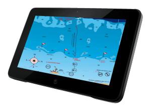
Satellite Navigation System Receiver (GPS Navigator or) receives signals from satellites, measures distances to them, and on the measured range solves the task of determining its coordinates - latitude, longitude and, when receiving signals from 4 or more satellites - heights above sea level , speed, direction (course) traveled path. The navigator includes a receiver with signal reception, a computer for their processing and navigation calculations, a display for displaying navigation and service information and a keyboard to control the operation of the instrument.
Such receivers are intended for a permanent installation in steering logs and on dashboards. Their main features are: the presence of a remote antenna and nutrition from external source direct current. They are usually large liquid crystal monochrome screens with alphanumeric and graphic display of information.
:
Compact Waterproof GPS / DGPS / WAAS receiver with high characteristics designed for small vessels. This GPS receiver from the company is able to accept and process additional DGPS / WAAS differential amendments. This feature provides, taking corrections from the radio beacon or geostationary Satellites Waas, use accuracy above 5 meters.
New (D) GPS navigator built-in receiver of differential amendments. Gasket technology allows you to accurately create high-range routes. It is possible to choose Locodromic course (RL) for short distances and orthodromic (GC) for long.
With the laying technology, the path allows you to accurately create high-range routes. It is possible to choose Locodromic course (RL) for short distances and orthodromic (GC) for long.
Stationary receivers are wide functionality, especially professional devices for use on the sea. They have a large amount of memory, the possibility of solving various navigation tasks, and their interface provides the possibility of inclusion in the vessel navigation system.
:
This is a modern GLONASS / GPS Navigation Satellite Satellite Satellite Reconciliation Designed for All Types.
Developed by the specialists of the Radio Complex with the latest achievements in the field of marine navigation. RK-2006 has the ability to receive signals of already deployed satellite groups, such as GLONASS and GPS, but also promising European and Asian positioning systems, this allows with increased noise immunity, and a security protected by any system, to determine the coordinates of the vessel and His course and speed.
A receiver of global navigation satellite systems GPS and GLONASS, from the South Korean manufacturer of marine radio navigation equipment SAMYUNG ENC CO., LTD - SGN-500.
When using GLONASS and GPS in combined receivers (almost all GLONASS receivers are combined) the accuracy of determining the coordinates is almost always "excellent" due to a large number of visible ka and their good mutual location.
Display navigation information
In GLONASS / GPS receivers, two ways to display information are used: alphanumeric and graphic (sometimes the term "pseudographic") is used.
The alphanumeric method for displaying received information uses:
- figures (coordinates, speed passed by way, etc.)
- literal combinations explaining digital data - usually abbreviations phrases (for example, MOV - "Man Over Board" or, in Russian - "Man overboard!"
- reducing words (for example, SPD - Speed \u200b\u200b- speed, TRK - Track - Route), waypoint names. The alphanumeric display of information in its pure form was used at the initial stage of the GPS technique.
The graphic method of display is carried out using drawings formed on the screen representing the nature of the motion of the carrier (vessel, car, human). Graphics in the devices of various firms are almost the same and varies, as a rule, in detail. The most common drawings are:
- electronic compass (not to be confused with magnetic!)
- graphic motion pointer
- track Movement, Routes
- symbols for waypoints
- ship coordinates
- direction on the waypoint
- speed
Characteristics:
Accuracy of determining location coordinates
The accuracy of determining the coordinates of the place is fundamental indicator Any navigation system, from the value of which will depend, how correctly the vessel will follow the laid route and will it fall into the nearby melels or stones.
The accuracy of the instruments is usually assessed by the value of the standard error (SCS) - the interval in which 72% of measurements falls, or at a maximum error corresponding to 95%. Most manufacturers' firms estimate their GPS receivers of 25 meters, which corresponds to a maximum error of 50 meters.
Navigation characteristics
The navigation capabilities of GLONASS / GPS receivers characterize the number of waypoints memorized by the instrument, routes and route points contained in them. Under the tracks are understood to navigate the characteristic points on the surface of modern can create and store, depending on the model, from 500 to 5,000 waypoints and 20-50 routes from 20-30 points each.
In addition to the waypoints in any receiver, there is a stock of points for recording and preserving the trail traveled. This amount can reach from 1000 to several tens of thousands of points in professional navigators. The recorded track can be used to return it back.
The number of simultaneously monitored satellites
This indicator characterizes the stability of the navigator and its possibility of ensuring the highest accuracy. Given the fact that to determine the two coordinates of the position - longitude and latitude - you need to track 3 satellites at the same time, and to determine the height of four. Modern GLONASS / GPS navigatorsEven wearable, have 8 or 12-channel receivers capable of simultaneously accepting and track signals, respectively, up to 8 or 12 satellites.
Today we will talk about what GPS is, how this system works. We will pay attention to the development of this technology, its functional features. Also discuss what role interactive cards play in the work of the system.
The history of the appearance of GPS.
The history of the appearance of a global positioning system, or determining the coordinates, began in the United States in the distant 50s during the launch of the first Soviet satellite into space. The brigade of the American scientists who followed the launch, noticed that at a distance, the satellite evenly changes its signal frequency. After a deep analysis of the data, they came to the conclusion that with the help of a satellite, if we speak in more detail, its location and the signal published, you can accurately determine the foundation and speed of the human movement on Earth, as the opposite, the speed and foundation of the satellite in orbit when determining the exact Human coordinates. By the end of the seventies, the US Defense Ministry launched the GPS system for its own purposes, and in a few years it became available for civilian applications. GPS system How does it work now? Exactly as it worked at the time, according to the same principles and basics.
Satellite network

More than twenty four satellites located in an near-earth orbit transmit binding radio signals. The number of satellites varies, but in orbit is always the right number of their number to ensure uninterrupted work, plus some of them are in stock so that in the event of a breakdown to take their functions on themselves. Since the service life of each of them is about 10 years old, the launch of new, upgraded versions is launched. The rotation of the satellites occurs at six orbits around the Earth at an altitude of less than 20 thousand km, it forms an interconnected network that is controlled by GPS stations. There are recent on the tropical islands and are associated with the main focal point in the United States.
How does a GPS navigator work?

Thanks to this network, you can find out the location by calculating the delay in passing the signal from satellites, and using this information to determine the coordinates. GPS system How does it work now? Like any navigation network in space - it is completely free. It works with high efficiency under all weather conditions and at any time of the day. The only purchase that should be, is the GPS navigator itself or a device that supports GPS functions. Actually, the principle of operation of the navigator is based on a long-used navigation scheme: if you know exactly where the marker object is located, the most suitable for the role of the reference point, and the distance from it to you, draw a circle on which the point mark your location. If the radius of the circle is large, then replace it with a straight line. Spend some such stripes from the possible location towards the markers, the intersection point of the direct will indicate your coordinates on the map. The aforementioned satellites in this case are just playing the role of these marker objects with a distance from your location about 18 thousand km. Although the rotation of them in orbit and occurs at a huge speed, the location is constantly monitored. Each navigator has a GPS receiver, which is programmed to the desired frequency and is in direct interaction with the satellite. In each radio signal contains a certain amount of Encoded information that includes a statement about the technical condition of the satellite, the location of it in the orbit of the Earth and the time zone (exact time). By the way, information on the exact time is the most necessary to obtain data on your coordinates: the time calculation of the period of time between the return and reception of the radio signal is multiplied by the speed of the radio wave itself and the distance between your navigation instrument and the satellite in orbit is calculated by short-term calculations.
Synchronization complexity

Based on this principle of navigation, it can be assumed that only two satellites may be needed to accurately determine your coordinates, based on the signals of which will easily find the intersection point, and in the end - the place where you are. But, unfortunately, technical reasons require the use of another satellite as a marker. The main problem is the clock of the GPS receiver, which does not allow sufficient synchronization with satellites. The reason for this is the difference in the time display (on your navigator and in space). On satellites there are expensive high-quality clocks on a atomic basis, which allows them to calculate the time with the utmost accuracy, whereas on ordinary receivers such chronometers are simply impossible cannot be applied, since dimensions, cost, the complexity in operation would not allow them to apply them everywhere. Even a small mistake at 0.001 seconds can shift coordinates of more than 200 km to the side!
Third Marker

So the developers decided to leave the usual system of quartz clocks in GPS navigators and go on another way, if we speak more precisely - to use instead of two satellite orientation - three, respectively, as many lines for the subsequent intersection. The solution to the problem is built on a brilliantly simple exit: with the intersection of all lines from three markers, even with possible inaccuracies, a zone in the form of a triangle is created, the center of which is taken by the middle - your location. It also allows you to identify the difference in the time of the receiver and all three satellites (for which the difference will be the same), which allows you to adjust the intersection of lines exactly in the center, simply speaking, it determines your GPS coordinates.
One frequency
It should also be noted that all satellites are sent to your device information at one frequency, and it is quite unusual. How does a GPS-navigator work and how does all the information perceive correctly, if all satellites continuously and simultaneously send information to it? Even pretty simple. Transmitters on a satellite to determine ourselves are sent in a radio signal to the standard information in which the encrypted code is located. It informs the maximum characteristics of the satellite and is entered into the database of your device, which then allows you to check the data from the satellite with the navigator database. Even when large quantities Satellites in the reach zone are very quick and easy to determine. All this simplifies the entire diagram and allows you to use smaller in GPS navigators and weaker reception antennas, which reduces the cost and reduces the design and dimensions of the devices.
GPS cards
GPS cards are loaded on your device separately, since you yourself affect the selection of the area you want to move. The system only establishes your coordinates on the planet, and already the card feature is to recreate the graphic version on the screen, on which the coordinates are applied, which allows you to navigate the terrain. GPS How does it work in this case? For free, it continues to stay in such a status, the cards in some online stores (and not only) are still paid. Often, separate applications for working with cards are often created for the instrument with the GPS navigator: both paid and free. The type of card pleasantly surprises and allows you to adjust the road from point A to the point B as informative as possible and with all the amenities: what sights you will drive, the shortest way to destination, voice assistantindicating the direction and others.
Additional GPS Equipment
The GPS system is used not only to indicate you the desired path. It allows you to surround the object on which the so-called beacon may be, or a GPS tracker. It consists of a receiver of signals and transmitter based on GSM, 3GP or other communication protocols to transfer information about the location of the object in service centresCarrying out control. They are used in many industries: security, medical, insurance, transport and many others. There are also automotive trackers that are connected exclusively to the car.
Traveling without problems

Every day the values \u200b\u200bof the map and a permanent compass go further into the past. Modern technologies Allow a person to pave the road for his wander with minimal loss of time, effort and funds, while seeing the most exciting and interesting places. What was fantastic about a century ago, today it became a reality, and practically each can take advantage of this: from military, sailors and pilots of aircraft to tourists and couriers. Now the use of these systems for commercial, entertainment, advertising industries is gaining great popularity, where every entrepreneur can indicate itself on the global world map, and it will not be difficult to find it. We hope that this article helped everyone who is interested in that GPS - how it works, according to which principle the determination of the coordinates, what its strengths and weaknesses are.
 Doesn't Diablo III start?
 How to check the computer to spyware
 Spyware on a computer